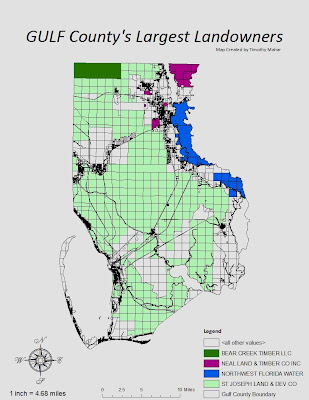
Easy lab which would have taken mere moments had the computer not chosen to perform random functions when i wasn't looking... fortunately i constantly resave because twice i had to shut down and come back into my saved map to continue. I would have preferred to rid the map of the gridded look but couldn't fand a way since the grid is part of the layer which shows the physical border as well. Placing the aceraga totals directly ON the map would have made sense but looked quite sloppy with the grid there as well, so i decided to skip them, trusting that the audience for this map would be able to tell easily enough that St Joe owns most of the county without needing a numner to confude the issue.
25 March 2010
Subscribe to:
Post Comments (Atom)


No comments:
Post a Comment